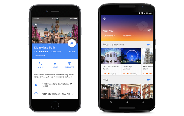
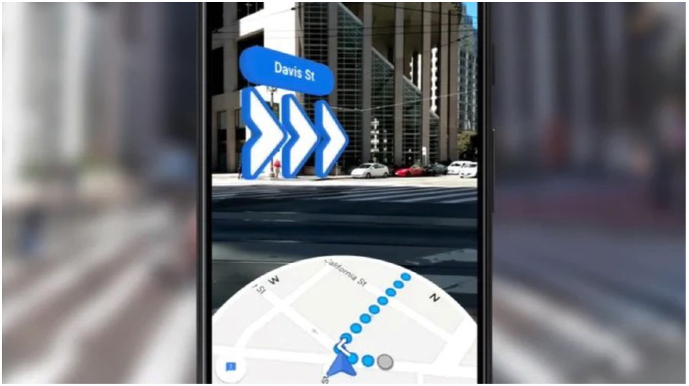
Google Maps is one of the most popular apps for navigation. The search giants map application helps millions of users every day find their way around the town. It even helps businesses like Uber and Ola in finding customers as well. Now, Google is seeking to finally integrate its AR capabilities to the maps for real-time directions. The new feature was announced earlier this year and is finally rolling out for Android and iOS.
Google Maps Live View
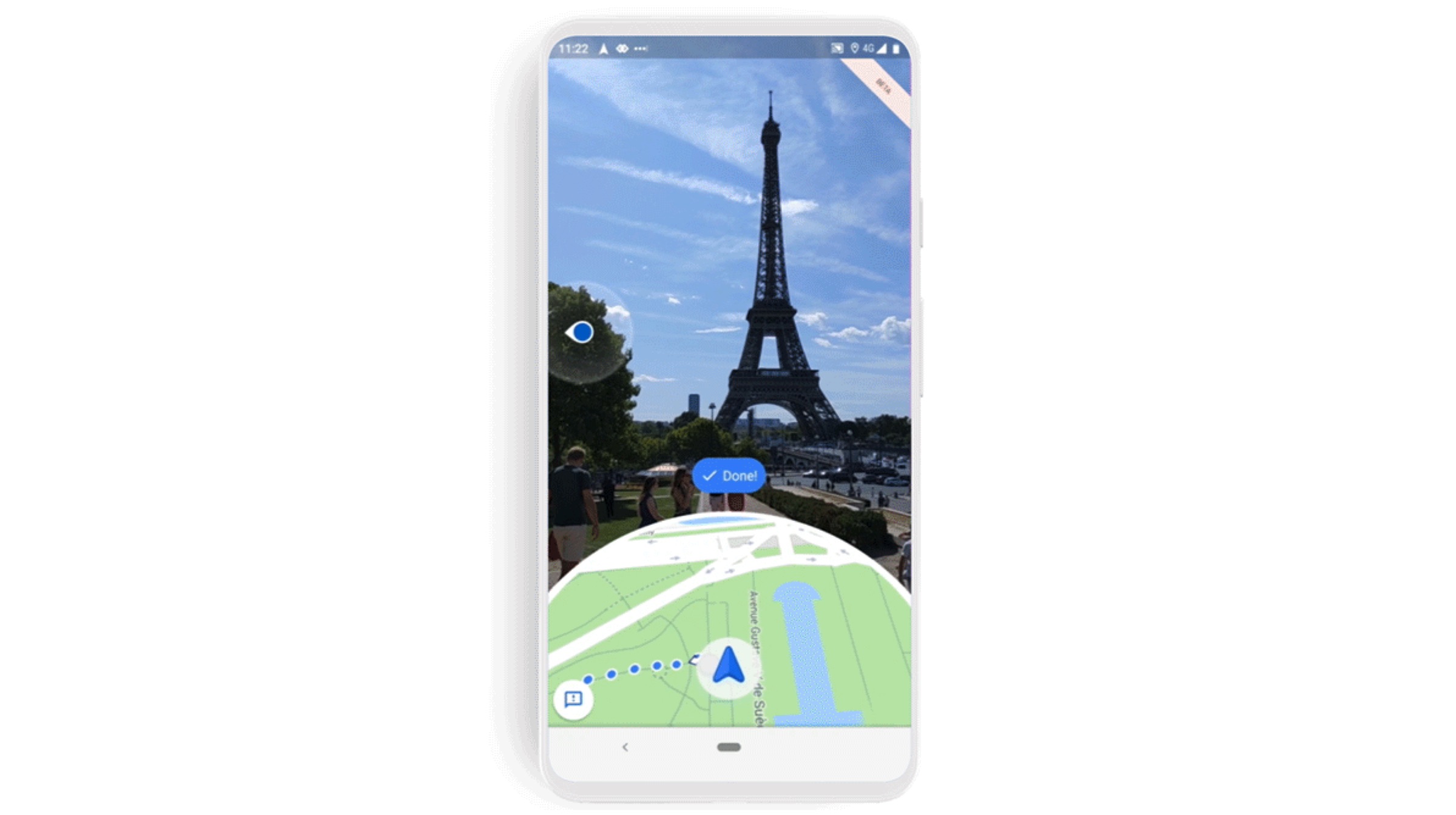
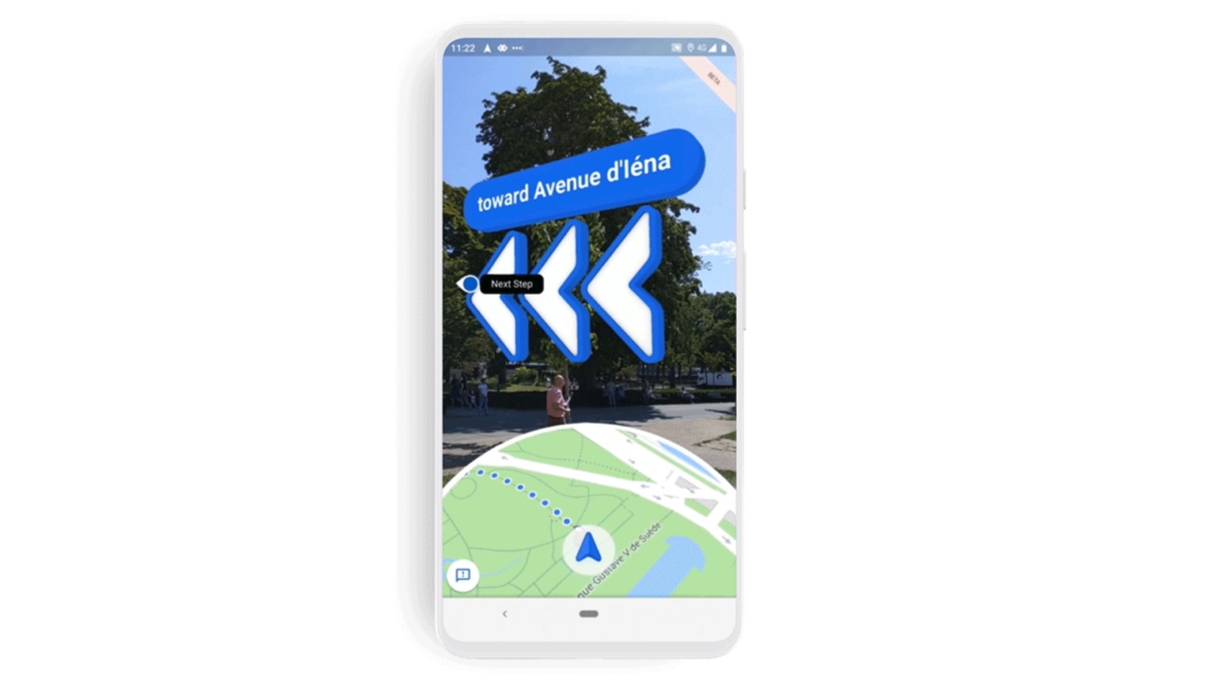
Google has already shown its prowess with augmented reality being integrated into smartphone cameras. It first appeared on Pixel phones and showcased real-time navigation in Google Maps through the lenses of handsets. The new feature allows users to hold up their phones and be directed via an arrow that provides direction to the destination.
The navigational features overlap on top of the camera view and make it far easier to locate buildings and landmarks around you. Nowadays, most modern smartphones feature an inbuilt function that facilitates augmented reality. In Android, it is called ARCore while iOS includes Arkite support. It allows devices to access Google Maps Live View which is in beta this week.
How To Try It Out
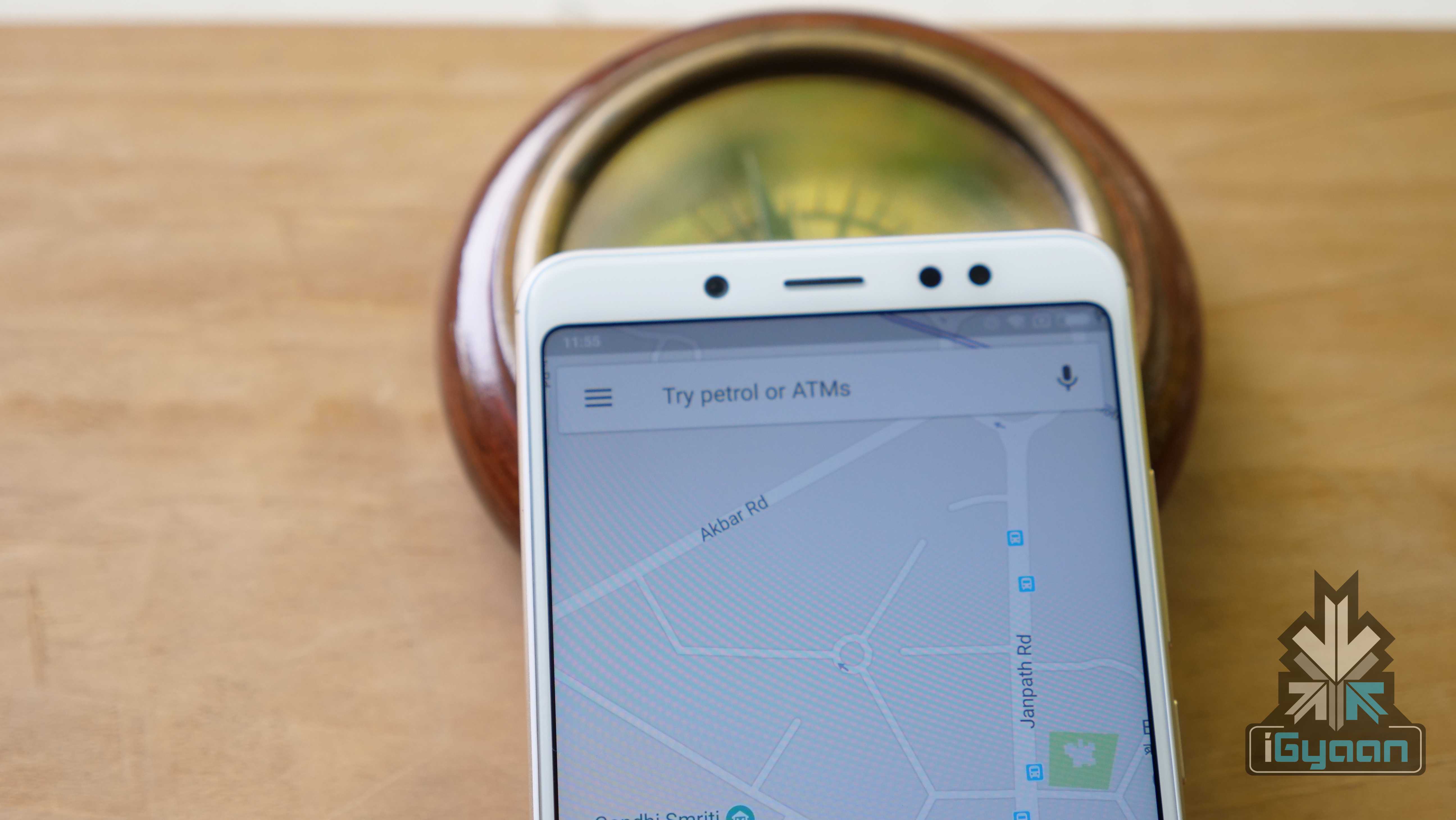
Users must first search for a location by typing it out or selecting it on the map.
Tap on the directions button at the bottom to start navigating.
Users must now select walking directions at the top of the screen.
Finally, tap on the new Live View option at the bottom of the screen.
The new Google Maps Live View feature is just a part of a much larger update to the mapping service. The company wants Travel and Maps to be a complete service through which trips are planned from the start to the end.
In a modern day world where time is money, information regarding an individual’s commute is extremely important. In Indian states like Mumbai where trains are the most common form of transportation for the masses, details regarding the status of various trains is quite crucial. In a new announcement, Google has unveiled its plans for adding practical (and much needed) features to Google Maps for its Indian user base.
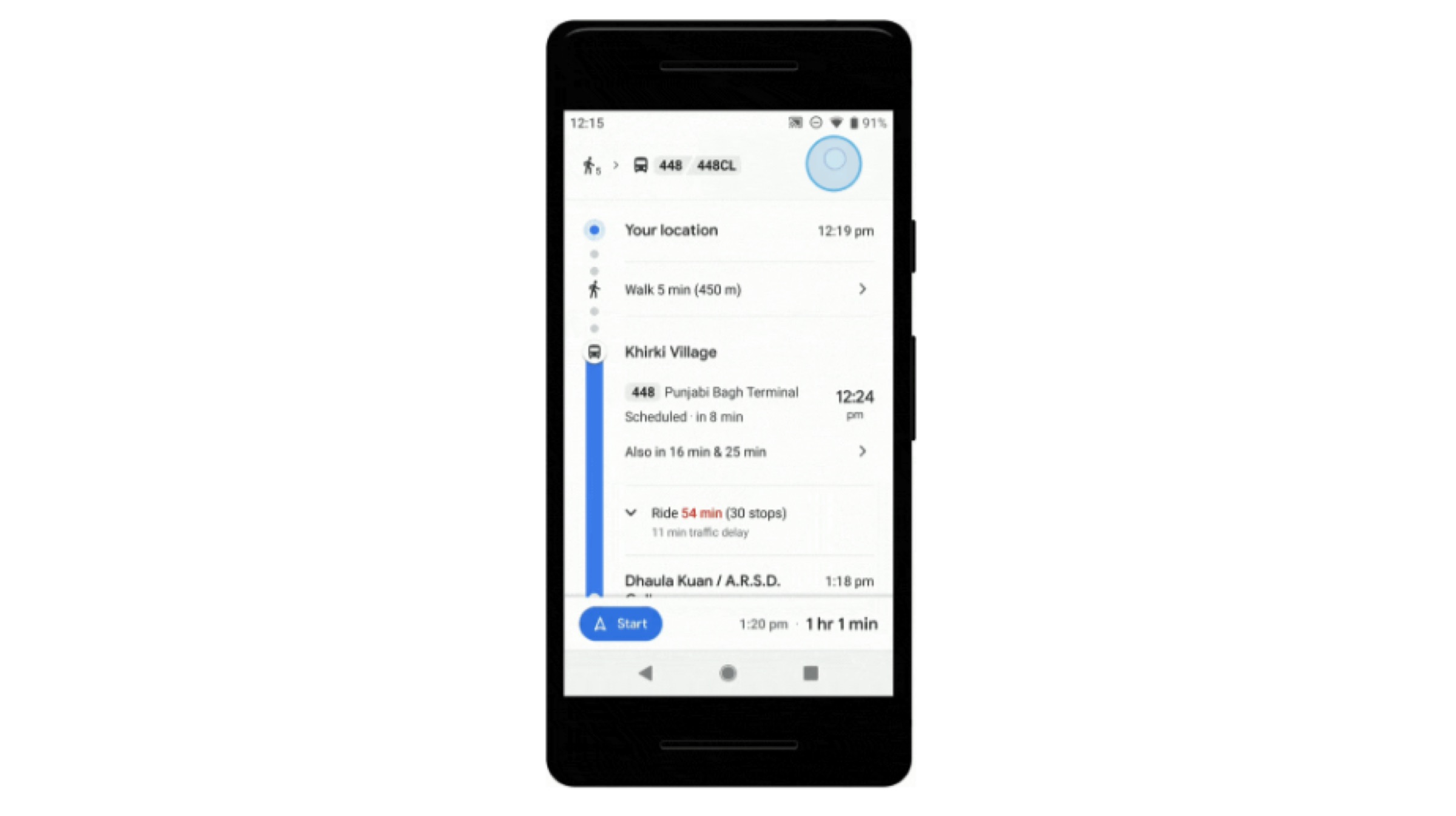
With the new update, Google Maps can provide the user with real-time information on bus travel times derived from live traffic conditions. Furthermore, users will now also be able to track live statuses of Indian Railway trains. The update is set to be introduced to ten major cities in the country. A mixed-mode commute feature will also be introduced. This feature combines auto-rickshaws with public transport for a more detailed route to the user’s destination.
Bus & Public Transport
The aforementioned feature will work hand-in-hand with Google Maps pre-existing live traffic data and public bus schedules. This will provide accurate travel times regarding buses in real-time. Bangalore, Mumbai, Hyderabad, Pune, Lucknow, Chennai, Mysore, Coimbatore, and Surat will be the first cities to receive this feature. The new update will be tested out for the first time in the real world and will help in relaying more detailed information regarding buses to the users.
Indian Railways
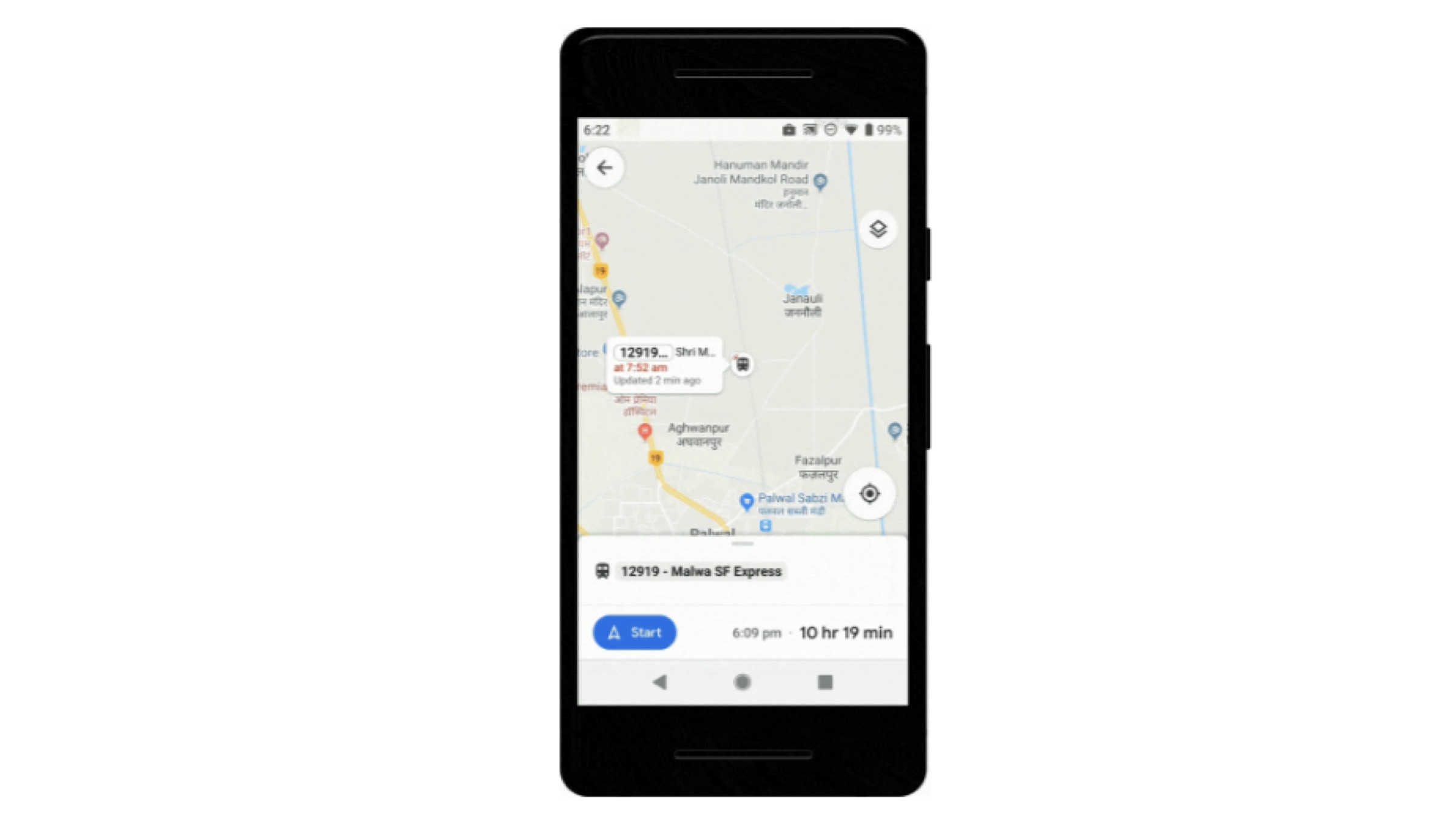
Trains will also receive a similar set of updates. Information regarding delays and travel times will now be available on Google Maps. Upon searching for the user’s current location and destination, the app will provide inter-state data regarding train routes. This feature was developed with the help of ‘Where is my train’ app, that was acquired by Google in the year 2018.
With the inclusion of the new mixed-mode feature, route results now also highlight auto-rickshaws. This form of travel is popular in India for quick and short duration rides. Google Maps will suggest rickshaws during trips in public transport only if it is a viable alternative. This particular feature, however, will be only available in Delhi and Bangalore and will eventually spread to other cities as well.
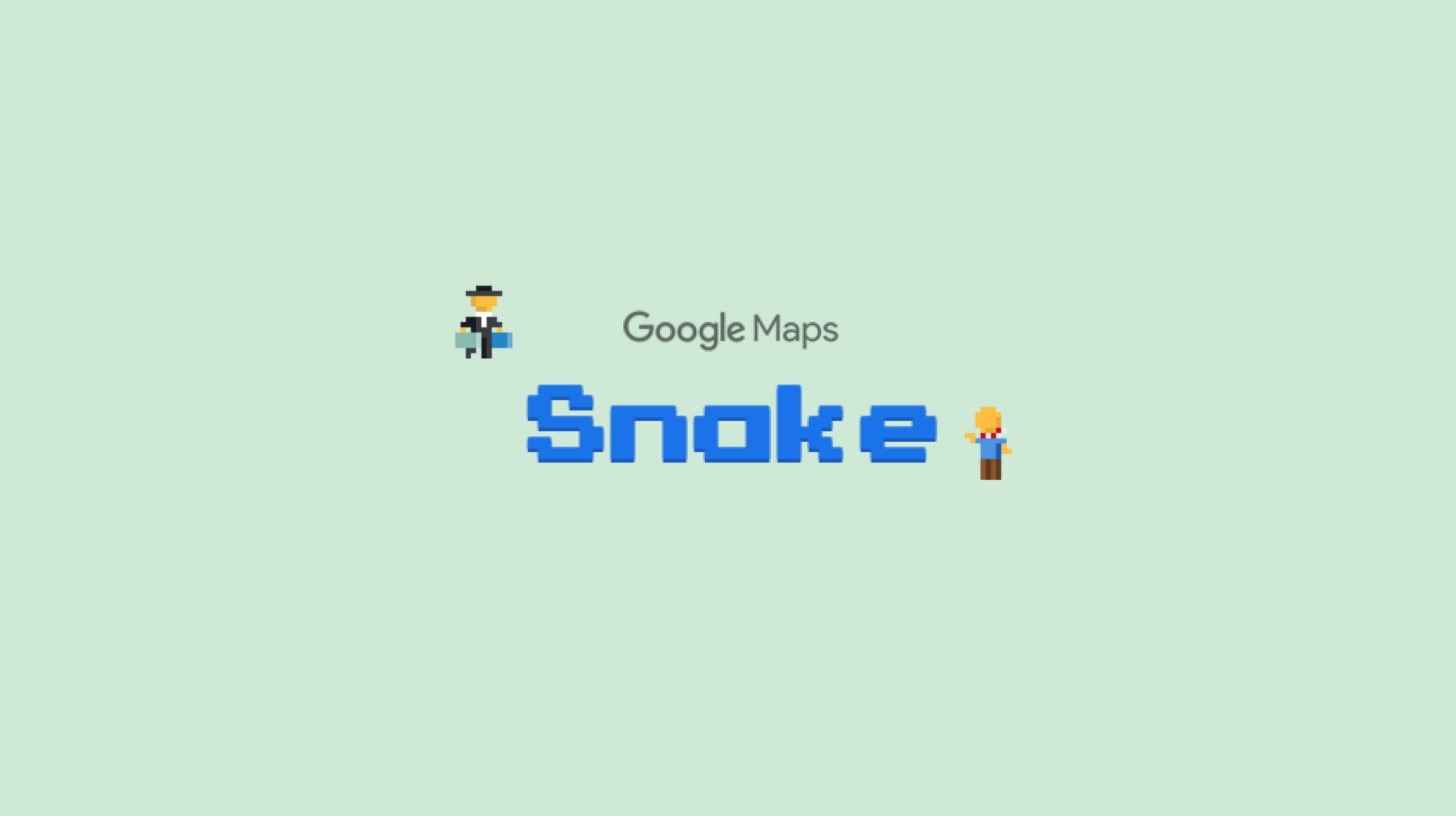
Google loves playing around with special events and festivals all across the world. The company is known for switching up the doodles to something fun and springy, which imparts a colourful look to the popular search engine. For April Fools, Google has introduced a modified version of everyone’s favourite game, which is “Snake”, and integrated it into the Maps app across both Android and iOS platforms.
The History of “Snake”
First introduced in 1997 on the Nokia 6110, the Snake game became an instant hit because of how simple and captivating it was at the same time. Needless to say, the game was continually modified into different forms as time progressed, but the basics remained the same. Users play as a snake, which has to keep eating “bits” or “food” to increase the score. Players would lose if they make contact with the walls or themselves while moving around the sandbox.
How To Play The Game?
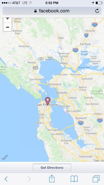
To experience the snake game on the Maps app, just open the sidebar in the application and select the “Play Snake” option. Note that the game doesn’t include a “classic” snake, instead, players will play as a means of transport if that makes sense. There are a total of six cities in the game, which are Cairo, São Paulo, London, Sydney, San Francisco, and Tokyo. Furthermore, there is also the option of a “world” map that users can check out. The vehicle depends on the city the players choose. For instance, if users choose to play in the London map, they will get to play as a double-decker bus, and if users select Tokyo, they spawn as a Bullet train.
Users can move the vehicle around by swiping in the desired direction on the 8-bit map, and pick up passengers that keep appearing on the screen. The game also includes some special “landmarks” such as the Burj Khalifa or the Golden Gate Bridge which grants extra points to the user. Users can play and make their own high score which can then be shared via different social media applications. Previously, Google added the legendary Pac-Man game to Maps in the year 2015 for the same event. The company has even set up a website for the game, which can be checked out by clicking here.
Google has already given us a view into the future, where augmented reality can be integrated into phone cameras. This happened at the Google I/O 2018, where Google showed off a demo with an advanced navigation system. The new nav system could guide users by showing pop-ups regarding nearby shops and businesses.
Google Maps: The AR Version
As per reports, the AR version of the Maps is still in the making. Google previously previewed another version for developers in May 2018. The interesting part of that was that Google showed maps on the lower part of the screen. The rest of the screen helped the user navigate the real-world surroundings. Google also used a blinking arrow system, which was almost alike to the arrow in Google’s previous presentation.
Map Warnings & Online Guides
Wall Street Journal’s David Pierce noticed some more intriguing details about this demo feature. After orienting itself to the surroundings, the Google AR version of Maps kept prompting David to put his phone down, so that he doesn’t hit an obstruction. Similarly, WSJ said that the app should be used by more users to test out its features. But the guide for the same wasn’t available anywhere on the app.
As far as digital guides go, Google also showed off an idea of a digital guide on the AR Maps app. One version of the app included an “animated guide”, which was called “Pizza Man”. Similarly, it can be possible that Google might have more characters/animals as app guides in the upcoming future.
One thing is for sure. The AR feature for Google Maps may take quite some time to release, depending on the number of integrations involved. Hopefully, it will available for testing by users sooner.
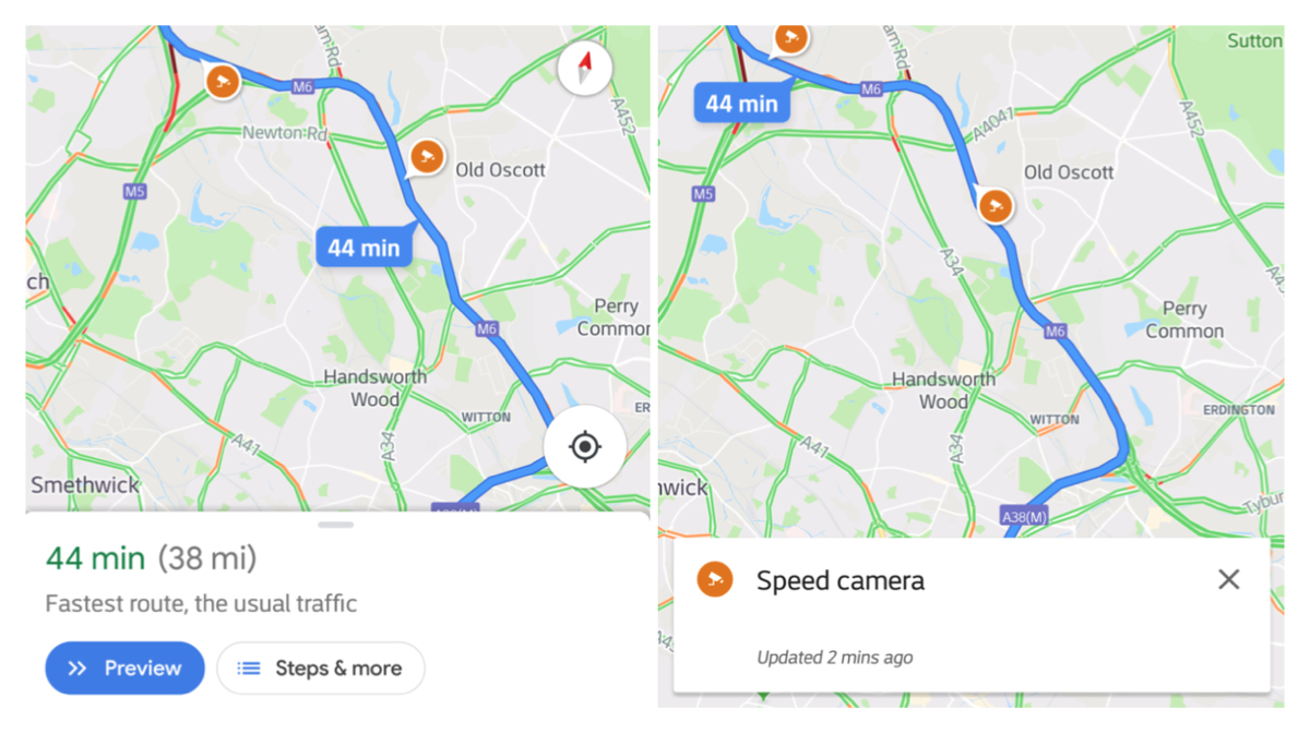
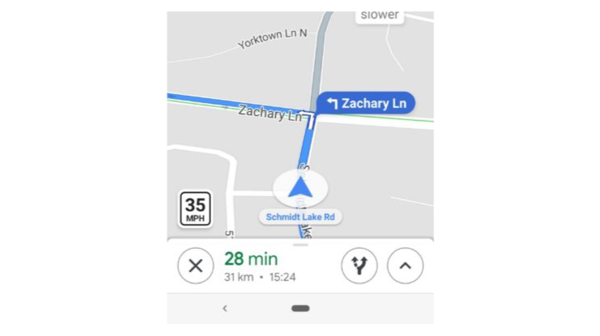
Google Maps has been constantly evolving and growing the features that it has. Very recently, they added support for Autorickshaws in India. Now, news suggests that they will add speed limits in their iOS and Android Apps.
The new feature adds a badge at the bottom left of the screen while the map is open and shows the speed limit of that particular road. It also displays speed traps. Speed traps are cameras installed in various roads to catch over-speeding drivers. These traps are shows with a small camera icon at the various locations the traps are based out of.
via-Android Police
Drivers will also reportedly get an audio notification when they’re approaching a speed trap. The speed limit update is supposedly rolling out in Denmark, the United Kingdom and the United States. However the speed camera icons are rolling out to Australia, Brazil, Canada, India, Indonesia, Mexico, Russia, UK and US users. According to a report, the speed limit feature was available in San Francisco Bay Area and Rio de Janeiro, Brazil for almost a year now. Since last year, in many areas, users can report a speed trap whenever they face or spot one. This is a welcome feature for people who have cars without smart displays. Those relying on their phones for navigation can use this feature to not over- speed in low speed zones.
A crowdsourced application called Waze had similar features which was extremely detailed. Google bought Waze in 2013 for nearly US$ 1 Billion. It seems like Google has kept it’s eye on the Maps market for a long time and is doing what the market demands. These new features will not only make the roads much safer to drive in, but also save drivers a lot of money in terms of fine for over- speeding through camera traps.
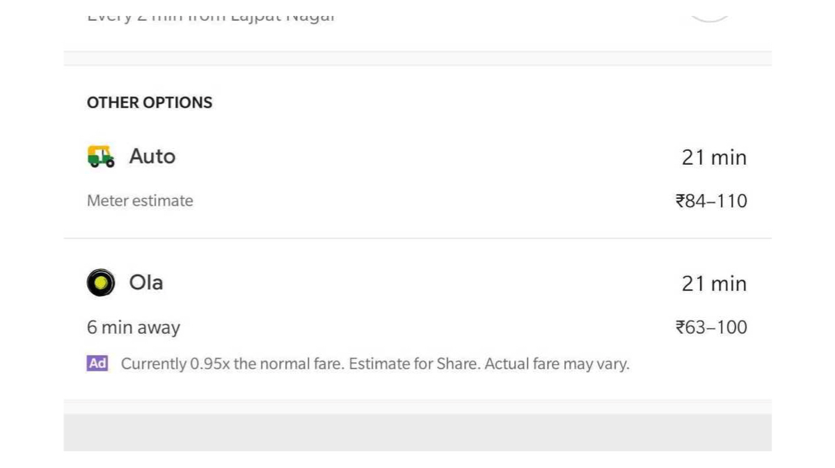
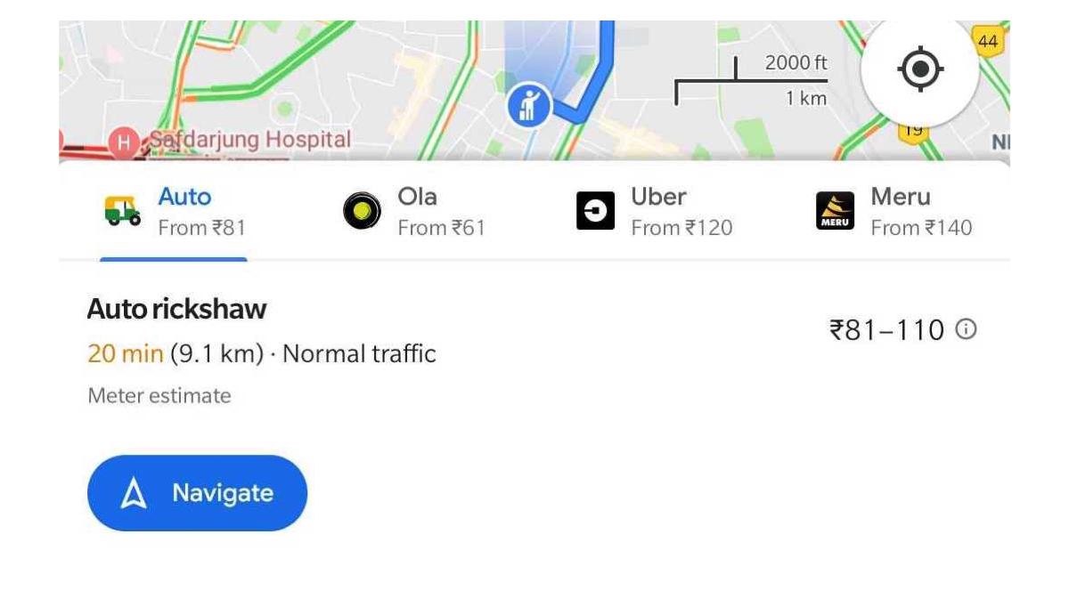
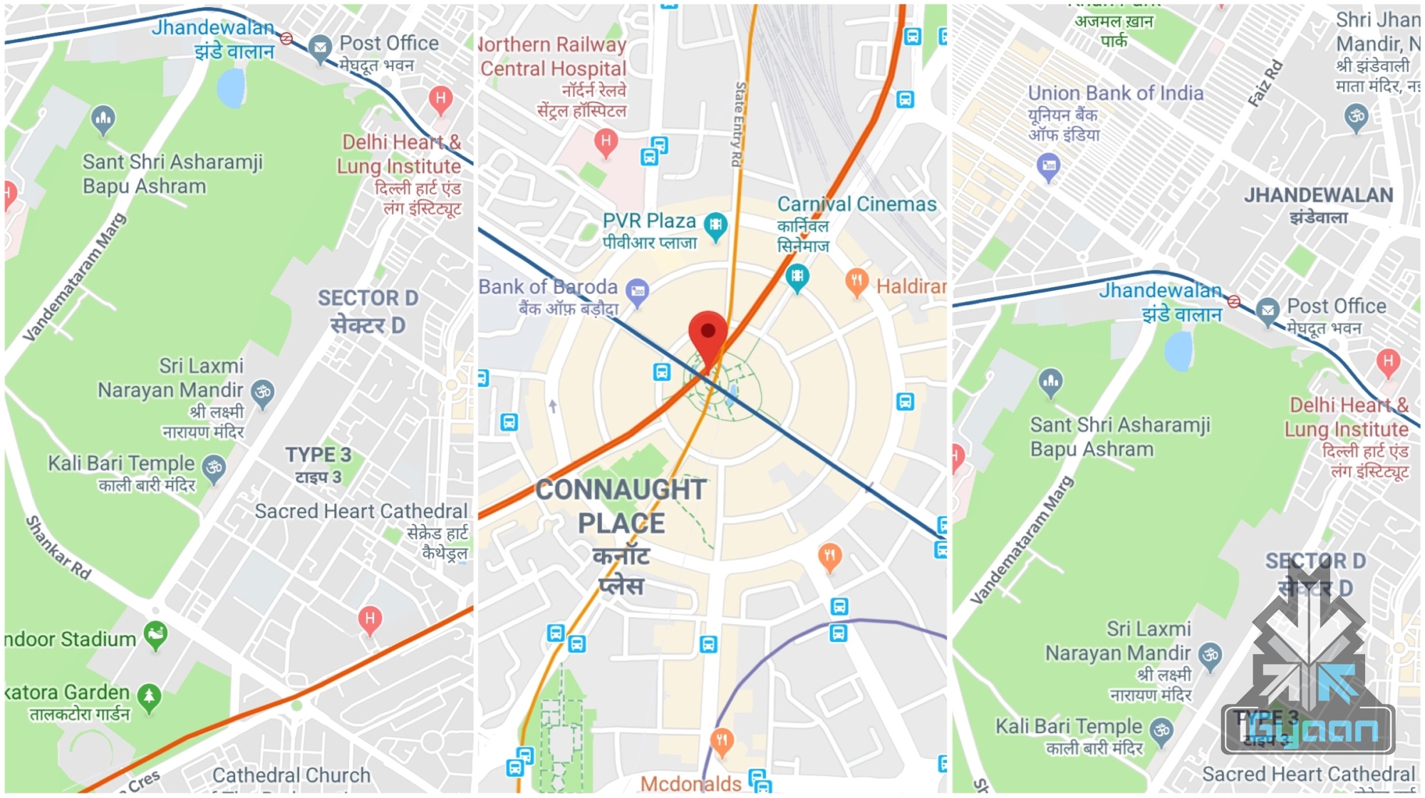
Google has been rolling out country specific features for a long time and it’s Maps feature is one of the best navigation tools in the world. While there are many India-specific features already available, a new feature that has been recently introduced can be extremely helpful for a lot of residents as well as travellers. The new feature allows you to see how long it will take to reach your destination in an auto rickshaw. It also shows the estimated cost for the travel. Indian auto rickshaws are infamous for not using their fare meter and overcharging. Many rickshaws use the fare meter and take tourists around a longer route to get an inflated fare. So we checked out the new feature on Google Maps and it is pretty cool! See how it works:
First thing is to check if the Maps app is up-to-date or not. Then open the app and select the location you wish to visit.
Second step is to select the mode of transport. Since the default is always a car or four wheeler, select the ‘Public transport’ section. This looks like a Train symbol which is on the right of the ‘Bike’.
Scroll to the bottom half of the screen on Google Maps and you will see an ‘Auto’ option in the ‘Other Options’ section. It shows the approximate cost and time taken for the journey.
You can also find different options for Taxi aggregators such as Ola, Uber and Meru cabs which show the estimated cost and allow you to directly jump to the respective apps for booking.
While the Auto feature in Google Maps is currently available in Delhi, the country’s capital, we hope Google rolls the feature out to other cities soon.
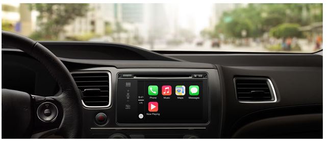
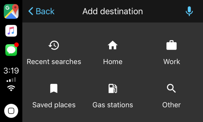
Apple announced iOS 12 at its recent launch event held on 12th September. The update will be rolled out on Monday, September 17th and will be available to many. An exciting feature that iOS 12 will bring is the addition of Google Maps and Waze to CarPlay.
Screenshots which show Google Maps integrated with Apple CarPlay have emerged and they have got everyone excited. As seen in the pictures, the Google Maps icon takes the navigation slot in the sidebar, which was earlier only occupied by Apple Maps. More images show the familiar arrowhead and map tiles, which are rendered by Google. The map is also available in both cartography and satellite modes. A microphone icon present on the screen also points out that voice search will be available.
CarPlay was announced in 2014 and works as an alternative to poor navigation software generally available in cars. By connecting your iPhone to your car, CarPlay will mimic its interface on to your dashboard. This is a much safer alternative to looking at your phone while driving or using a car mount.
However, the biggest complaint that CarPlay users had is the fact that they could not use Google Maps and were stuck with Apple Maps when it came to navigation. This is no longer an issue as with the new iOS update, users will be able to access not only Google Maps, but many other apps as well.
The access to Google Maps on Apple CarPlay is relatively restricted. It will only be available to iOS Beta Testers. For now, users will have to upgrade to iOS 12 when it rolls out on Monday and wait. Once Google Maps and other compatible apps are updated to be integrated with Apple CarPlay, users can utilise the full experience.
Google Maps is one of the most used services across all platforms. Even until Apple unveiled iOS 6 in 2012, the company relied on Google Maps. However, even to this date, many prefer Google over Apple maps for navigation. For a long time, Google has been optimizing its Maps services to provide better and more accurate results. However, there are times when the company goes above and beyond to ensure accuracy. According to reports, the company is secretly tracking its users’ location even after they turned their location history off. According to the company, if a user has turned his or her location history off then it will no longer be able to track their location. But, that does not seem to be the case.
As a new user, Google would ask the user to allow it to track his/her location for navigation. Once allowed, the entire location history of the user is recorded in a timeline fashion. This means that the company can keep a track of all the users who opted in for its map services, putting their privacy at risk. To deal with this, the company allows the user to turn off their location history. This, at least on paper, prevents the company from storing its users’ location. However, Google is still able to track its users with the help of some of the company’s apps. For instance, a simple Google search for a particular food item like a biscuit could help pinpoint your precise location. Moreover, the company even stores the instances of the times when you open its map service on a device. While mostly been open about tracking its users’ location, the company has never explicitly mentioned that it stores their location history even while turned off. It is with this privacy issue that more than two billion devices are at risk.
The issue of data privacy and the risks involved with it has always been a major concern. It does not help to know that big league companies like Google can misuse their users’ information. There is no word from the company on this issue but stay tuned as we will closely cover this news.
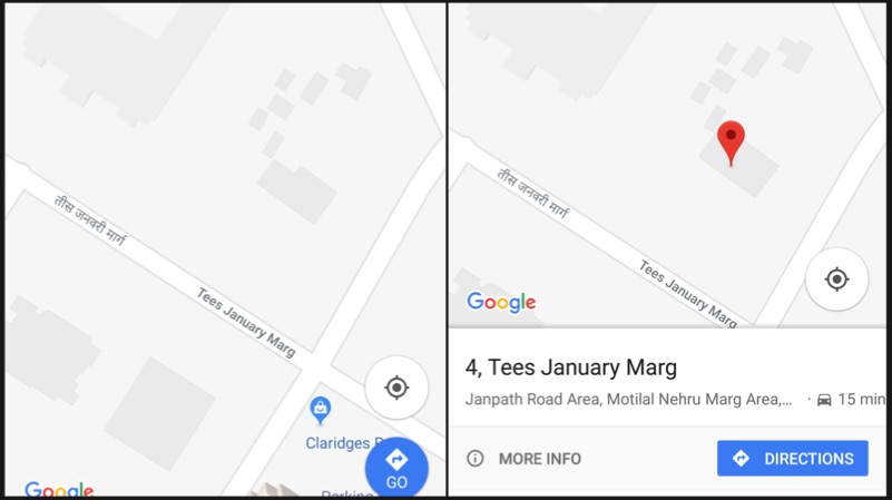
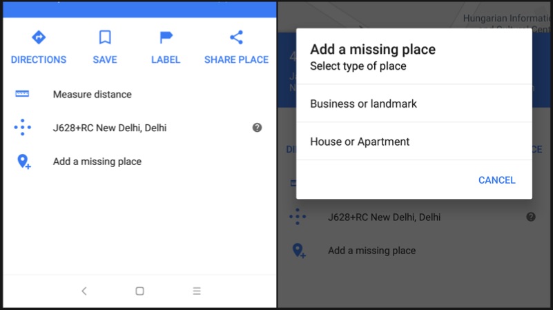
Google Maps recently announced a bunch of new features for India. These new features ease the process of searching or sharing an address. The company has combined area code with the local code to generate a unique “Plus” code for every geographical area. The Google Maps Plus code can be broadcasted across social media platforms for sharing.
Google Maps Plus Code
The Google Plus code is a combination of GPS location details and the local area pin code. Up until now, Google Maps let the users share direct GPS locations. However, with the Google Maps Plus Code, the sharing of location is a lot easier. This feature is available for both Android and iOS operating systems.
How to add missing Address
Open Maps
Touch and hold the place to select the marker
Click on the description of the place
Click on “Add a missing place” option
Enter the details such as name, website etc and press the arrow mark on the top right corner
How to generate Plus Code
Open Maps on your iOS or Android device
Touch and hold the place to select the marker
Click on the description of the place
Scroll down to the bottom to find the Plus code
Copy the code by pressing on it
How to search an address using Plus Code
Copy and paste the code into Google Maps search bar and hit enter to find the navigation for the address
Or simply, copy paste the code into Google search, and the address will be shown in the search results
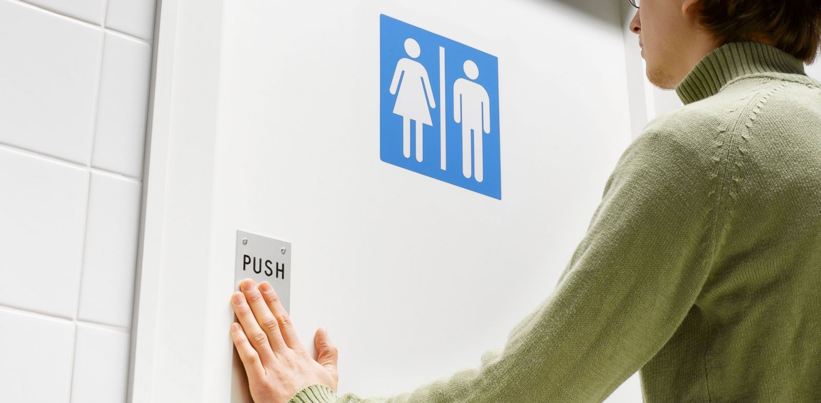
Google has partnered with the Indian Government to launch a toilet finder built into Maps in India. India has one of the worst toilet problems in the world. With over 70 % households lacking basic toilet facilities, this tool aims to help people with access to smartphones, which surprisingly is more than those with toilets.
Google and the Ministry of Urban Development in India have made this tool simple enough that a user can search in multiple Indian languages for words like “toilet,” “lavatory,” “swachhata” and “shulabh.”
This is also a crowd sourced platform which will populate the condition and availability of toilets as users use it more and more. It is expected to be rolled out in the coming months, however, no proper timeline exists.
Now if only Google could work on a currency filled ATM finder, India would be a better place.
The company introduced Apple Maps in 2012 and ushered in a series of glitches which involved the Madison Square Garden, New York being labelled as a ‘park space’ because of the word ‘garden’ in its name. However Apple acted promptly, fixed these goof-ups and now three years later Apple Maps has overtaken Google Maps as the most used navigation app on iPhones.
Even though Apple Maps lacks many features which Google Maps provides, users end up using the former more because it is already installed on their devices. Even if the phone has third party apps, Siri and Mail automatically take the user to Apple Maps. This, along with Apple’s efforts to improve the over-all experience of the app, has helped them get more users to choose Apple Maps over other options.
Google Maps, on the other hand, has not lagged behind either in improving itself. Starting last month, it now allows users to store maps and data on their phones to refer to it even without internet access. It also includes search tools for landmarks and business listings, transit maps that cover more region than Apple and options to exclude highways and toll roads.
As more and more iPhone users switch to Apple Maps, do you think Google Maps could be a better choice?
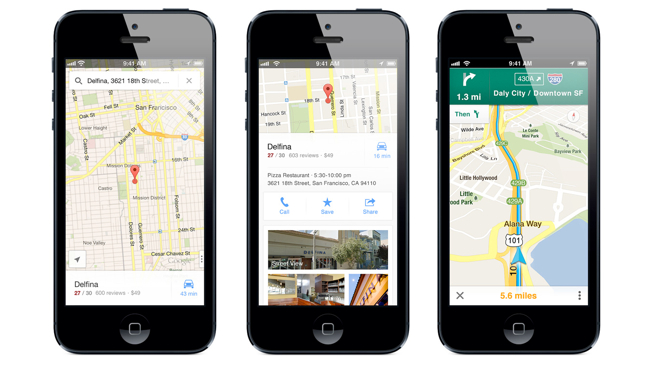
One of the features of the modern day lifestyle is the GPS tracking devices on our Android or iOS phones and laptops, with the most famous tracking app being, Google Maps. We all know how this works regardless of whether we own a smartphone or not. Google Maps already knows your location so you just have to add your destination address and voila, it shows you the way.
Image Source: Mashable
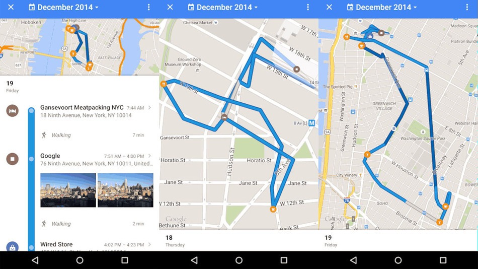
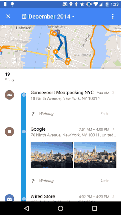
This app is usually helpful, but there are times when Google Maps either takes you to some remote location or you forget which road to take etc. Although, Google Maps previously did have a location history setting, now, it has come out with a new feature called Your Timeline.
The new Timeline is curated in a more efficient way than the location history and allows you to rename a location or remove a location and allows you to check where you were at any given time.The location history of the Timeline is private and can be deleted by the user from the settings menu. The new feature also allows you to control your account settings if you don’t want Google to track your location history.
The new Your Timeline feature is soon to be out for desktop users too.
Mobile phones have become an extended appendage to our bodies. Today though, with the stable establishment of the Smartphone, our lifestyle and etiquette has entirely changed. We embraced this change of modernity without much resistance, although it doesn’t hurt to wonder what it would have been like otherwise.
The Word ‘Selfie’ Would Not Be a Part of the Dictionary
The still trending culture of the ‘selfie‘ would be non-existent and one would have to learn how to perfect the art of holding one’s digital camera awkwardly. It helps that the new smartphones now come with a good front camera with up to 8MP HD clarity.
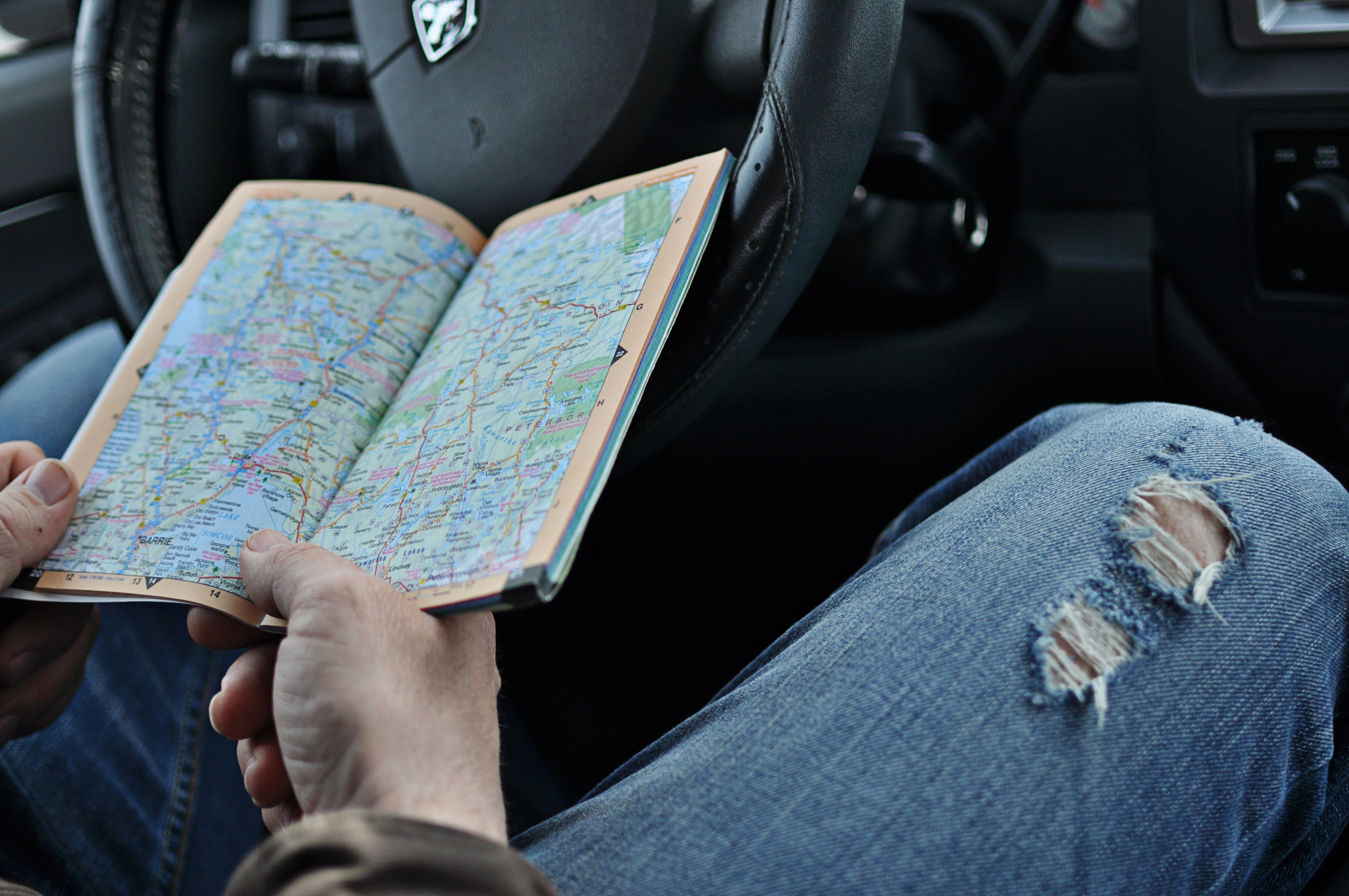
We Would be Rolling Down Our Car Window to Ask for Directions
Shopkeepers and road signs or even a REAL map would show us the way instead of the GPS or Google Map.
Image Source: Raising Gentlemen
Our Pictures Would Have #NoFilter
Instagram has nothing less than a cult following since its introduction. The App allows people to publish their photographs and has by far, the most aesthetic editing options that any photo editing app could offer. Although saying that it revolutionized picture quality and the art of photography would be going too far.
Source : Emarketing Blog
No Video Chats On-the-Go
At one point Skype was the only means to video chat across the world. It seemed like a revolutionary idea until the advent of the smartphone and along with it multiple video chatting apps such as FaceTime, Viber etc.
Remember SMS?
Two of the most popular apps for informal communication have changed the world of text messaging. Now we barely ever fill up our texting balance because we would rather use the Wi-fi to text, call, send jpeg images, voice notes etc.
Source : Mashable
We’d Still be Buying Cookbooks, Dictionaries, and Books in General
With the introduction of reading apps like Kindle, Aldiko Book Reader, Cool Reader etc. we have almost stopped opening Dictionaries, Cook Books and buying special edition magazines and novels. The reading app has become so much a part of our culture that Sunday morning Church services also involve the congregation taking out their mobile phones instead of The Bible. The mantra being, ‘less is more’.
Downloading and Storing Music
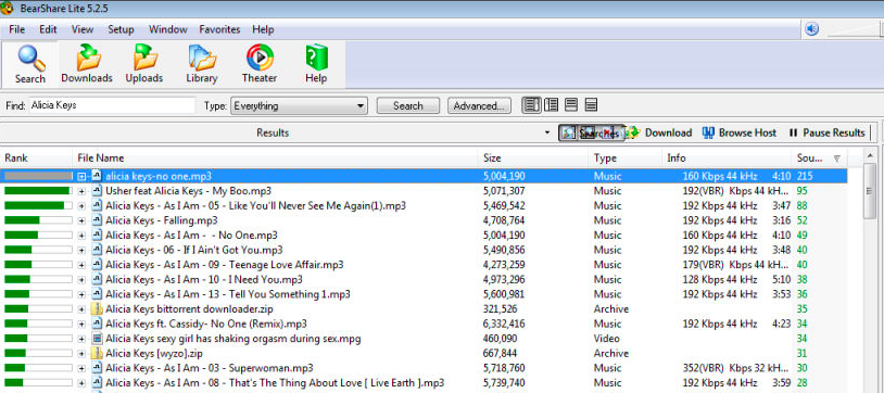
Today music enthusiasts don’t need to go to Music Stores in order to buy their favourite albums. In fact they don’t even need to buy an MP3 player or even the life changing iPod. All one needs to do is own a smartphone with apps such as SoundCloud, Apple Music, Spotify etc and you have it all in tow.
We should also be thankful that we’re no longer downloading music (along with a hundred viruses) from Limewire or Bearshare.
Candy Crush and Angry Birds Probably Wouldn’t Exist
Long ago in the 90s, if we wanted to play computer games we would have to go to the gaming parlours to experience the ultimate fun of gaming. Even when the feature Nokia mobile phone arrived the only game they had was called Snakes and it was joyous!
Arguments Wouldn’t Be Resolved Until Someone Located a PC/Laptop
Initially internet access would only be available to computer users and those who did not own one would have to visit Cyber Cafes. The feature phone too did not have a Wifi or data connection option and therefore the Cyber Cafés and computer business thrived. But with the coming of the smartphone and all its internet options most people now choose to buy a smartphone which has all the functions of a laptop or PC and have internet access on the go.
Without our smartphones, everytime anyone got into an argument, it wouldn’t be resolved till someone located a PC/Laptop.
To-Do Lists
The emergence of reminder apps have alone perhaps dropped the sales of efficient and creative stationary like sticky notes, labels, notebook fridge magnets etc.
In conclusion, a world without the smartphone would still be beautiful but perhaps won’t be able to keep up with the notoriously infamous ‘fast-paced modern’ lifestyle.
Apple has been facing stiff competition on its Maps services from Google Maps. But, according to MacRumors, one company has been added to Apple’s roster to help it improve its Mapping service exponentially. The Silicon Valley technology company has confirmed the purchase of Coherent Navigation, a Bay Area global positioning company that will help Apple to further boost its location technology and services.
Google maps has always been ahead of the game
Coherent Navigation was formed back in 2008 and focused on creating commercial navigation services that were based on partnerships with companies like Boeing and Iridium, a satellite network operator. This company has worked on highly precise navigation technologies, which are accurate to up to 3-5 metres. Coherent Navigation had also worked on autonomous navigation and robotics previously. The company is known for its High Integrity GPS system, which combined signals from mid-earth orbit GPS satellites with low-earth satellites to offer improved precision and accuracy.
According to MacRumors, some key employees have started working for Apple, including CEO Paul Lego in January and co-founders William Bencze and Brett Ledvina in April. Their Linkedin profile also confirmed that they are working at Apple. The company’s website is currently offline but was updated to Apple servers on 30th April.
For now, neither Apple nor Coherent Navigation has provided any information about how this partnership will be moved forward or what technology would be used. It is likely that Apple may show off the new navigation system at the WWDC next month. Watch out, Google Maps!
HERE maps, previously known as Ovi Maps or Nokia Maps, is an alternative of Google Maps and Apple Maps service. Nokia was in talks with buyers to sell out its maps unit, but seems like Facebook has inked a deal to power maps on its various platforms.
The social networking site is presently using Here maps on the mobile version of its website, and on other applications like Facebook Messenger and Instagram. The Facebook spokesperson confirmed the same through statement –
We are testing Nokia HERE maps across Facebook to give us more control and flexibility in delivering a consistent maps experience.
Nokia confirmed that it is seeking buyers to sell out its $2 billion Here map. The Finnish tech brand spent $8.1 billion to buy Chicago-based digital map maker, Navteq, in an effort to capitalize its market for mobile search, but the buy-out deemed unprofitable. Hence, in April, Nokia roped in the heavyweights of technology including Apple, Facebook, Amazon, Alibaba Group, etc. to sell its maps business. According to Techcrunch, one of those potential buyers has already sealed a deal with Nokia.
For now, Facebook has not given any details about its availability on iOS.


 First introduced in 1997 on the Nokia 6110, the Snake game became an instant hit because of how simple and captivating it was at the same time. Needless to say, the game was continually modified into different forms as time progressed, but the basics remained the same. Users play as a snake, which has to keep eating “bits” or “food” to increase the score. Players would lose if they make contact with the walls or themselves while moving around the sandbox.
 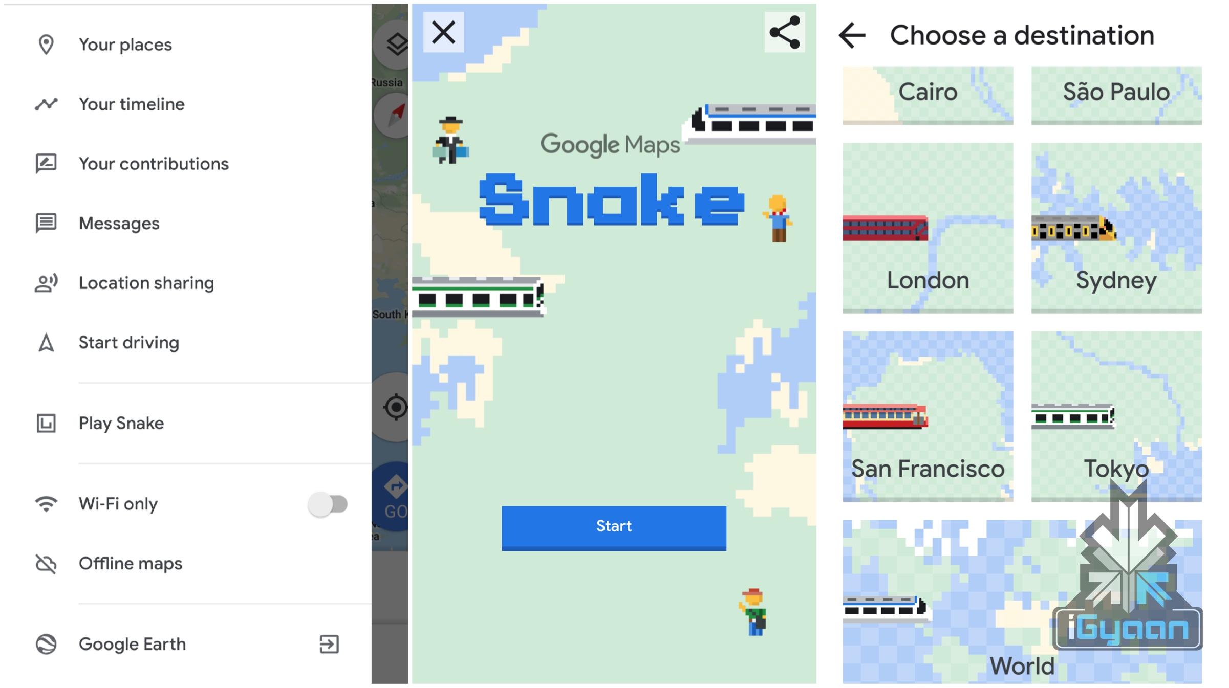 To experience the snake game on the Maps app, just open the sidebar in the application and select the “Play Snake” option. Note that the game doesn’t include a “classic” snake, instead, players will play as a means of transport if that makes sense. There are a total of six cities in the game, which are Cairo, São Paulo, London, Sydney, San Francisco, and Tokyo. Furthermore, there is also the option of a “world” map that users can check out. The vehicle depends on the city the players choose. For instance, if users choose to play in the London map, they will get to play as a double-decker bus, and if users select Tokyo, they spawn as a Bullet train.
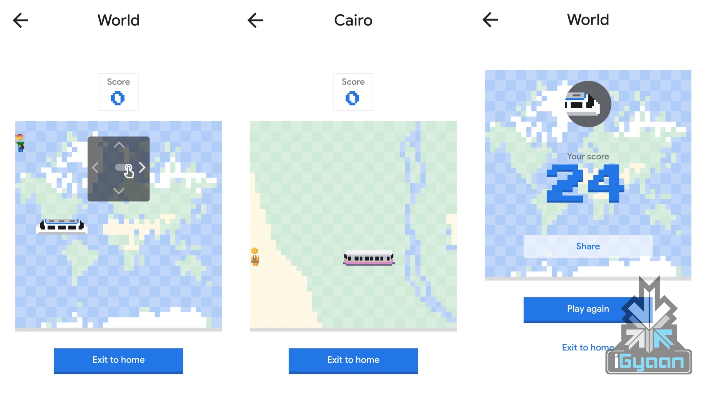 Also Read:
  As per reports, the AR version of the Maps is still in the making. Google previously previewed another version for developers in May 2018. The interesting part of that was that Google showed maps on the lower part of the screen. The rest of the screen helped the user navigate the real-world surroundings. Google also used a blinking arrow system, which was almost alike to the arrow in Google’s previous presentation.
 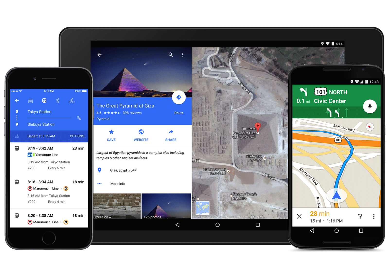 Wall Street Journal’s David Pierce noticed some more intriguing details about this demo feature. After orienting itself to the surroundings, the Google AR version of Maps kept prompting David to put his phone down, so that he doesn’t hit an obstruction. Similarly, WSJ said that the app should be used by more users to test out its features. But the guide for the same wasn’t available anywhere on the app.